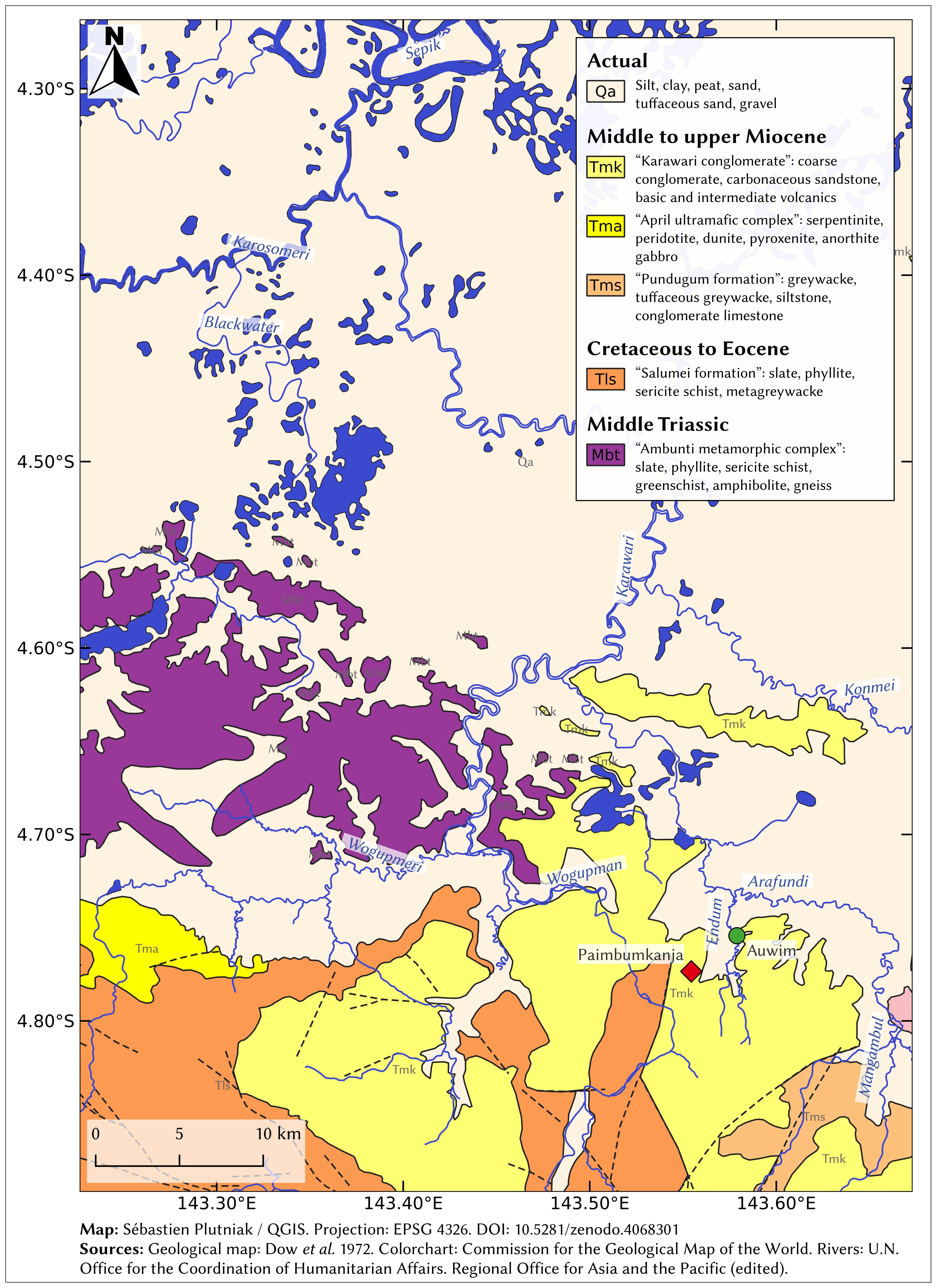
Geological map of southern Sepik area (Papua New Guinea)
Carte géologique de la zone sud du Sepik (Papouasie-Nouvelle-Guinée)
Résumé
Geological map of southern Sepik area (Papua New Guinea), locating the archaeological site of Paimbumkaja and the main watercourses.
Map generated using QGIS. Projection: EPSG 4326.
Sources:
Geological map: Dow, D. B. and Smit, J. A. J. and Bain, J. H. C. and Ryburn, R. J. 1972. The Geology of the South Sepik Region, New Guinea, Canberra: Australian Government publishing Service, ISBN 0-642-00082-4.
Colorchart: Commission for the Geological Map of the World.
Rivers: U.N. Office for the Coordination of Humanitarian Affairs. Regional Office for Asia and the Pacific (edited).
Origine : Fichiers produits par l'(les) auteur(s)

