Integrated geophysical surveys at the archaeological site: the buried complex IV, XVII, 4 in Ostia (Rome, Italy). Part 4. Magnetic field map
Résumé
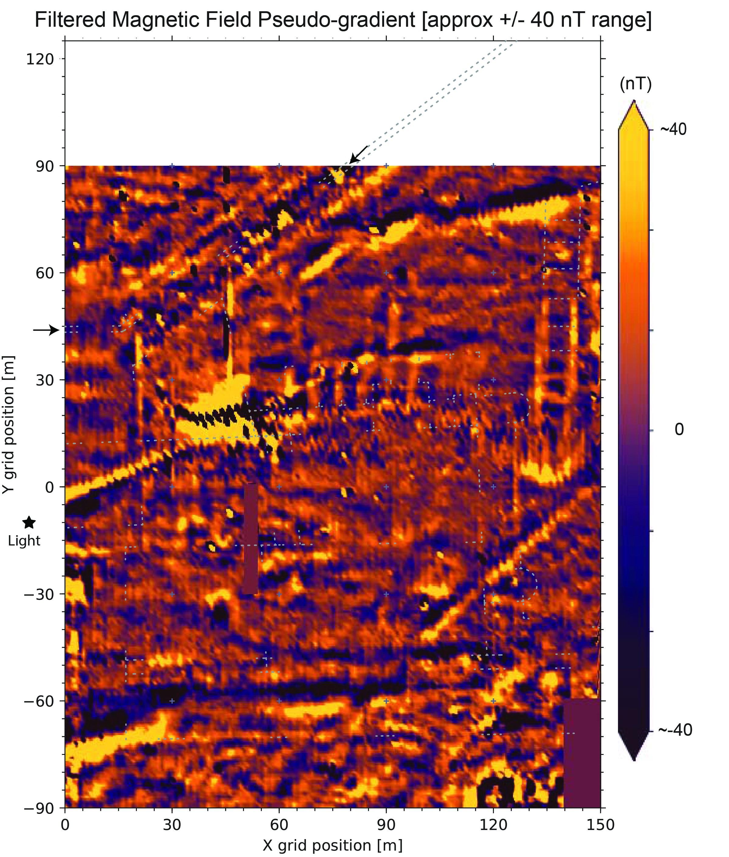
These maps are the results of the research, focused on the complex east of the Baths of the Porta Marina, is part of a research project on the coastal area of Ostia carried out by the Centre Camille Jullian, CEREGE and MAP-CNRS in collaboration with the Archaeological Park of Ostia Antica.
The integrated study of geophysical prospections (electrical resistivity tomography, magnetic field mapping, electro-magnetic survey), satellite images and topography allowed to define the characteristics of a large complex covering an area of approx. 15,000 m2.
In particular, the presence of a large open area, flanked by a building with a basilical plan, makes it possible to recognize the structures of a forum. The location at short distance from the ancient coastline allows to identify the "Aurelian’s forum" and the praetorium known from the Historia Augusta.
Origine : Fichiers produits par l'(les) auteur(s)


